Features PrecisionView
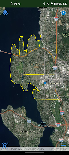
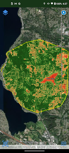
We map out your fields and IoT device locations on the Esri ArcGIS™ platform.We add layers: aerial imagery, soil maps, topography, and more.Bring Your Own Drone (BYOD) Data, or we can source Drone Flyers and Satellites with near-infrared and thermal cameras to collect aerial imagery.
📸
Camera Features
Advanced camera features with editing capabilities.
🏠
Smart Home
Control and monitor your home with smart features.
Screenshots
See the PrecisionView in Action
Get the App Today
Download on Google Play
Available for Android 8.0 and above